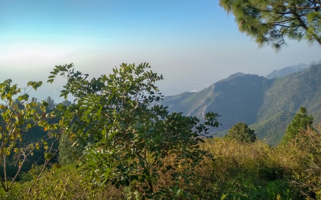
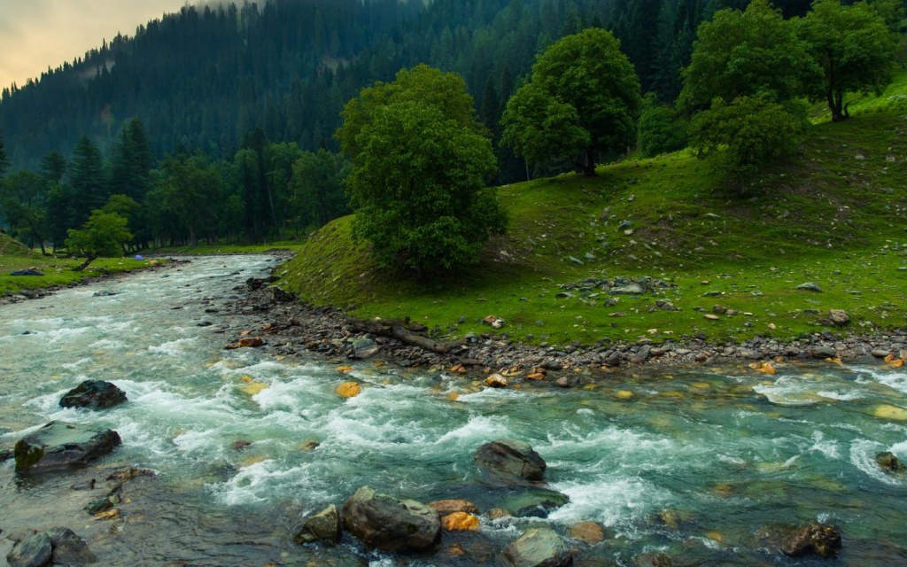
Majestic mountains, green meadows, wild life, gushing rivers and
pristine lakes – there is a lot more to Pakistan than just travel
warnings. Picturesque views, natural landscapes and some of the most
unique lakes and mountains is what makes Pakistan one of the coolest places to visit in 2019.
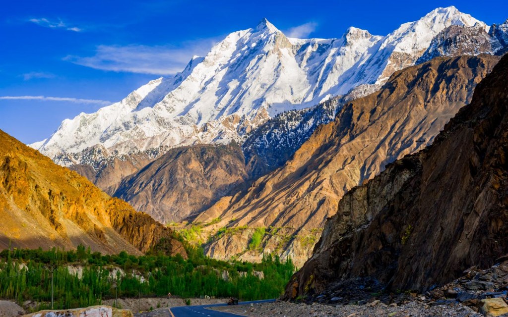
It is home to around 108 mountain peaks that are above 7000 meters.
That is why we have some of the best hiking trails in the world. While
it doesn’t take a lot of effort to view the beauty of these skyscraping
peaks from a distance, discovering the secrets of these natural wonders,
in person, requires a lot of hard work. For example, once you get off
the Karakoram Highway, you can see the mountains are quite near.
However, it takes a laborious trek to explore this place. That said, the
sights that you’re blessed with along the way turn it into an
experience of a lifetime. If you also wish to have a similar experience,
you might want to go over our list of the 10 best hiking trails in
Pakistan.
Popular Hiking Trails in Pakistan
Margalla hills track
Dunga Gali-Ayubia track
Miranjani Track
Deosai national park
Passu to Lake Borit
Chitta Katha Lake
Gurez Valley Track – Kel to Taobat
Minapin to Rakaposhi base camp
Naltar Valley
Fairy Meadows and Nanga Parbat Base Camp
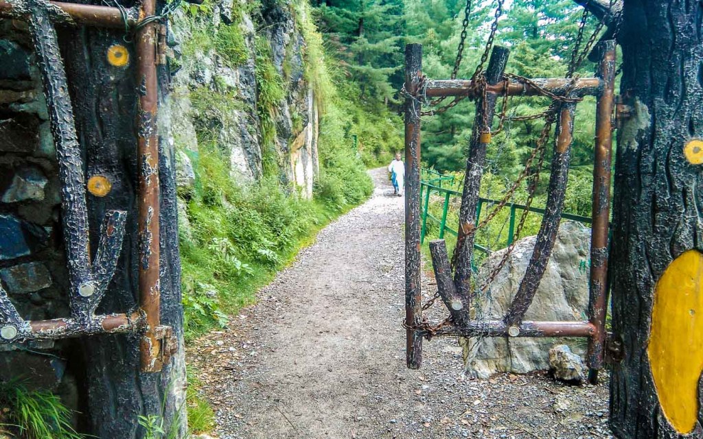
Margalla Hills Track
Margalla Hills offers shorter treks and is therefore quite popular among city folks
The best part about Margalla Hills Track is that it is nestled in the
capital city. For the residents of Islamabad, a hiking trip to the
extension of the great Himalayas is right at their doorstep. Most
probably, you will start off with your trek tour either from Islamabad
or Lahore. Nonetheless, you will get the first glimpse of the beautiful
Himalayas from the former city. There are at least six marked hiking
trails in Islamabad, named Trail No. 1, Trail No. 2, Trail No. 3, Trail
No. 4, Trail No. 5 and Trail No. 6. The most popular hiking trail in
Islamabad is Trail No. 3, which is short and steep. Remember that you
need to labor for at least 45 minutes to reach a vantage point. These
trails crisscross each other and, therefore, you have the advantage of
either going for a longer hike or shortening your trip for a shorter
trekking experience. Even the longest hiking trail in Islamabad takes
only around 2 to 2.5 hours. Among shorter treks, this one is arguably
among the best hiking trails in Pakistan.
Dunga Gali – Ayubia Trek
The hiking trail from Dunga Gali to Ayubia is a short 5 km hike
Dunga Gali to Ayubia hiking trail is more commonly known as the
‘Pipeline Track.’ This was discovered because it follows an important
water pipeline route which was used to service this historic hill
station in Murree. The hike from Dunga Gali to Ayubia, which is located
within the boundaries of the expansive Ayubia National Park, is not as
tedious as some would expect. It’s only a 5 km short hike and is just a
couple of hours’ drive up northeast. Thick pine forests against the
backdrop of sky-impaling mountains make for a spectacular scenery.
Perfect for selfies if you’re an Instagram aficionado.
Miranjani Trek
Those who go for trekking at Miranjani can also enjoy the beauty of Nathia Gali
Towards the north of the Pipeline Track is a hill station called
Nathia Gali, near Abbottabad. From Nathia Gali, if you walk for 2 to 3
hours, you will reach the summit of a mountain called Miranjani. The
track up the hill begins at the Nathia Gali Bazaar and passes through a
beautiful series of Dagri Naka Mountains. This hike will take you
through evergreen subtropical forests. Those who go for trekking at
Miranjani can also enjoy the beauty of Nathia Gali, where you can find
plenty of places to stay at. Thankfully, it is not as fully crowded as
Murree is in summer. You will also find many places having word ‘gali’
in their name, which means ‘valley.’ Therefore, this entire region
uphill, towards the north, is called ‘Galyaat.’
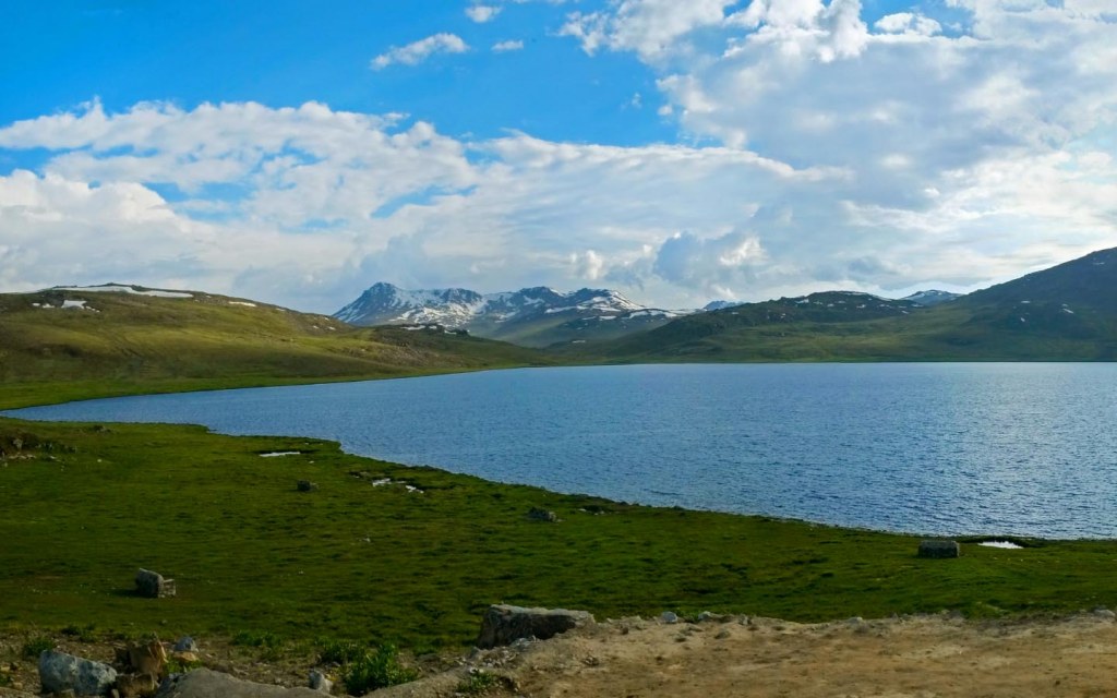
Deosai National Park
Deosai National Park is a beautiful meadow with wildflowers and green pastures
The second largest alpine plateau in the world, Deosai sits at a height of over 4,000 m, and spans across 3,000 square kms. Itis
located in Gilgit-Baltistan, in the northwest of Pakistan. Deosai means
the ‘Land of the Giants.’ The moment you look at this beautiful meadow
with wildflowers and green pastures, you understand why it is called the
Land of the Giants.
In order to protect the Himalayan brown bear, local authorities
created the Deosai National Park. As the snow thaws in summer, meadows
spring to life with wildflowers blooming, bees buzzing and butterflies
fluttering – making it a veritable paradise on Earth. As is evident by
its name, it’s also a wildlife sanctuary. The trek through Burji La Pass
to Deosai is a long and tiring route and one of the most difficult
hiking trips in northern areas. Most people who want to trek, first get a
jeep from Skardu and then drive to the park. Pick up a guide from there
and then, within a few days of trekking, you reach the mesmerizingly
beautiful Sheosar Lake. This is, hands down, one of the best hiking
trails in Pakistan.
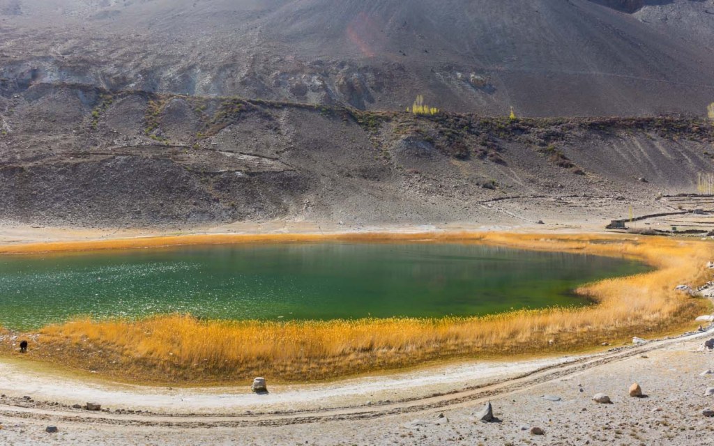
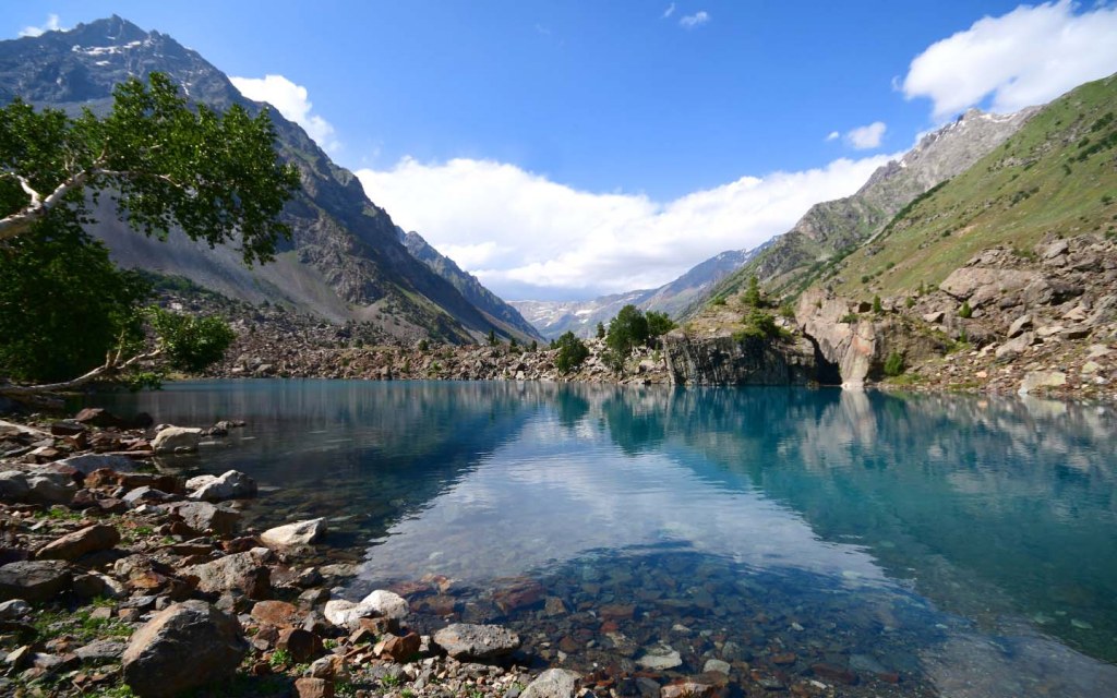
Passu to Lake Borit
Beautiful Borit Lake is roughly 2,600 metres above sea level
Passu is a village named after the Passu Cone mountains and a bridge
crossing a raging river. It is located in the Hunza Valley. This is one
of the more difficult hiking trips in northern areas because it is a
relatively remote location. This beautiful hike begins at the bridge
over Passu River. Every now and then you can stop by and marvel at the
impressive Karakoram range. From a little up the hill, Passu River
appears like an oasis amidst the rugged mountains piercing the sky.
Keep following this route until you see a glacial lake. A few more
long strides while following the ridge towards the other side and you
will find Lake Borit. Moving further at a short distance is the bright
turquoise coloured Lake Attabad. This place is a dream come true for any
trekker. You stay transfixed, looking at the picturesque views this
place has to offer.
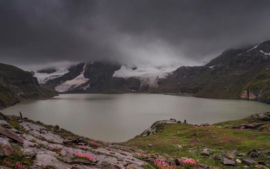
Chitta Katha Lake
The treacherous climb uphill from Shounter to Chitta Katha Lake goes from 3,000 meters to 4000 meters
Pakistan has some of the most amazing lakes like mirrored surfaces
surrounded by green meadows in snow-capped mountains. Chitta Katha is
like those lakes. It is in Shounter Valley, located in Azad Kashmir. It
is not far from Areng Kel, which is another popular tourist spot. You
can also hike here for an hour or so.
This exciting hike to Chitta Katha Lake begins with a jeep ride from
Kel. From there till Shounter Valley, you have to rely on a jeep. Once
you reach Shounter Valley, you need to find a guide as the trails going
further from this are not marked. The treacherous climb uphill from
Shounter to Chitta Katha Lake goes from 3,000 meters to 4000 meters.
This changes the scenery dramatically. From beautiful alpine forests to
somewhat barren land – it is truly a rewarding hike . The views over the
lake are beyond description.
The ninth highest mountain in the world – Nanga Parbat can be seen
from a distance. This is one of the most exciting hiking trails in
Pakistan. You will go trekking for almost 12 hours, which makes it one
of the longest hikes in Pakistan for true adventure-seekers. You can
also camp at Nanga Parbat. Stock up on food items and essential
equipment for camping. You can also check out our list of the dos and don’ts of traveling to northern areas of Pakistan.
Kel to Taobat
Taobat is a village in Athmuqam Tehsil in Neelam Valley, Azad Kashmir
Gurez Valley is situated in between Kel and Taobat. It is a huge
stretch of greenery which goes all the way to Neelum River. This
laborious hike is quite long and it can take multiple days. It all
depends upon how many challenges you can take or if you want to stop
over every now and then and marvel at the beauty that unfolds. Kel is 25
miles away from Taobat. You don’t have to walk all the way, but just
like all the other difficult hiking trails in Pakistan you wouldn’t want
to kill the excitement by opting for a vehicle. Travelling in a jeep in
Pakistan is a wonderful experience, however, some places call for
closer, more personal, observation.
You will be welcomed by spell-binding beauty, picturesque views lined
with pine forests, cherry-laden trees and small wooden cabins of the
local people. The lush green fields give a sense of calm while the
hospitality of the local people will fill your heart with warmth. You
would want to come again and again to explore the unmatched beauty of
the region that spreads from Kel to Taobat.
Minapin to Rakaposhi Base Camp
The stunning snow-capped mountains of Rakaposhi fill you with awe
Gilgit-Baltistan is home to the 27th highest mountain in
the world – Rakaposhi. It has a tricky climb to its summit. Since 1958,
when the first expedition to Rakaposhi was successful, only eight
expeditions have conquered it. Most people enjoy traveling to the
Rakaposhi Base Camp, which is comparatively quite easy. All you need is
basic mountaineering gear and you’re good to go.
Trekking in this area seems a bit difficult but not too much. You can
start off with your trek tour from a village named Minapin. The first
few meters are quite tough with a steep path that unwinds as you
proceed. After a few hours you will reach the base camp. If you want,
you can spend the night here and experience beautiful panoramic views of
green pastures set against spectacular mountains — simply splendid!
Naltar Valley
Reflection of blue Naltar Lake at Naltar valley in Gilgit-Baltistan
Towards the west of Rakaposhi base camp is the enchanting Naltar
Valley. Skiing competitions are often held during winters, while in
summers, it becomes a hotspot of one of the best hiking trails in
Pakistan. Naltar Valley is set in a forest with gigantic mountains
engulfing the valley. Although a jeep ride in Pakistan is fun, but it
only shortens the trekking experience, which can be so rewarding. You
don’t want to miss any bit of Naltar Valley while travelling in a jeep.
Although you will have to take a jeep ride to travel 25 miles from
Gilgit to Naltar Valley. Once you reach there, you can then start your
trek tour from Naltar Valley to Naltar lakes, which are 3 in number –
all strikingly beautiful having different colours – green, dark green
and third one is a beautiful hue of azure.
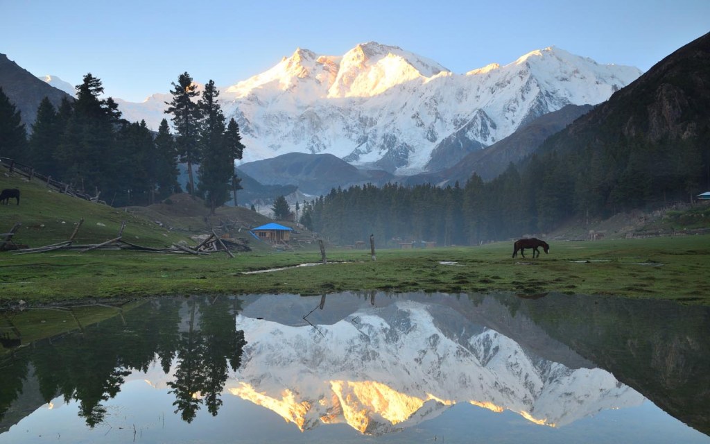
Fairy Meadows and Nanga Parbat Base Camp
The ninth highest mountain peak in the world, Nanga Parbat can be seen from the highest point of Fairy Meadows
As the name suggests, Fairy Meadows is an enchanting place that looks
straight out of a fairy tale. The best time to visit this place for an
adventurous hike is around the month of August. It doesn’t snow at this
time of the year. Trekking to Fairy Meadows is quite easy. The ninth
highest mountain peak in the world, Nanga Parbat can be seen from the
highest point of Fairy Meadows. The views are spectacular, to say the
least.
So, this was our pick of the best hiking trails in Pakistan for
adventure-seekers. However, if you are visiting the northern parts of
the country and, somehow, can’t make it beyond the capital city, you can
check out these tourist spots in Islamabad.


0 Comments